
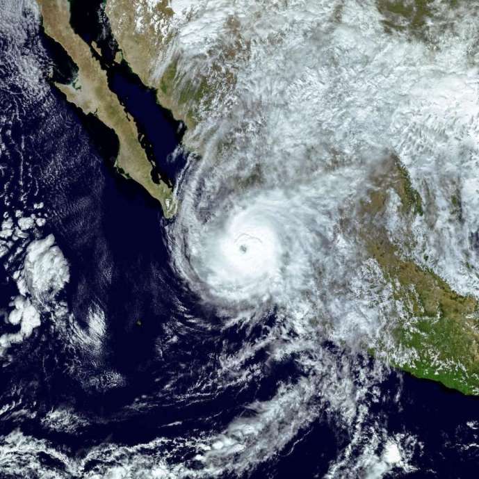
Hurricane Polo is bringing powerful winds and the threat of life-threatening flooding to Mexico’s northern Pacific coast as the Category 3 storm approaches Baja California Sur.
The hurricane is packing maximum sustained winds of around 115 mph (185 km/h) and is expected to make landfall on Monday evening. The storm is forecast to move inland along the coast of Baja California Sur before continuing toward southern Sonora on Tuesday morning.
The U.S. National Hurricane Center has warned that dangerous winds and flash flooding have already begun affecting parts of the region. Forecasters have urged residents to move to safe shelter as conditions are expected to deteriorate rapidly.

Flooding, Storm Surge and Dangerous Surf
Along with destructive winds, Polo is expected to produce a significant storm surge accompanied by large and potentially destructive waves. Heavy rainfall could trigger life-threatening flooding and mudslides, particularly in mountainous and steep areas.
Dangerous surf and strong rip currents are also expected along parts of Mexico’s northwestern coast and Baja California.
In Cabo San Lucas, a popular tourist destination known for its famous natural rock arch, authorities have restricted access to beaches. Several restaurants have closed, while residents and businesses have secured properties and stocked up on essential supplies, including food and drinking water.

Authorities Prepare for the Storm
Mexico’s Civil Protection authorities have taken precautionary measures ahead of the hurricane. Travel is expected to be suspended in areas near the anticipated landfall zone, while ports have been closed.
The government of Baja California Sur has ordered schools to remain closed on Monday. Temporary shelters have also been opened for residents who may need to evacuate.
Federal authorities have deployed thousands of navy and army personnel, along with specialized equipment, to support emergency operations.
Forecasters have also warned that Polo’s remnants could continue to produce strong gusty winds after the storm weakens, potentially affecting parts of southern New Mexico and western Texas.
