
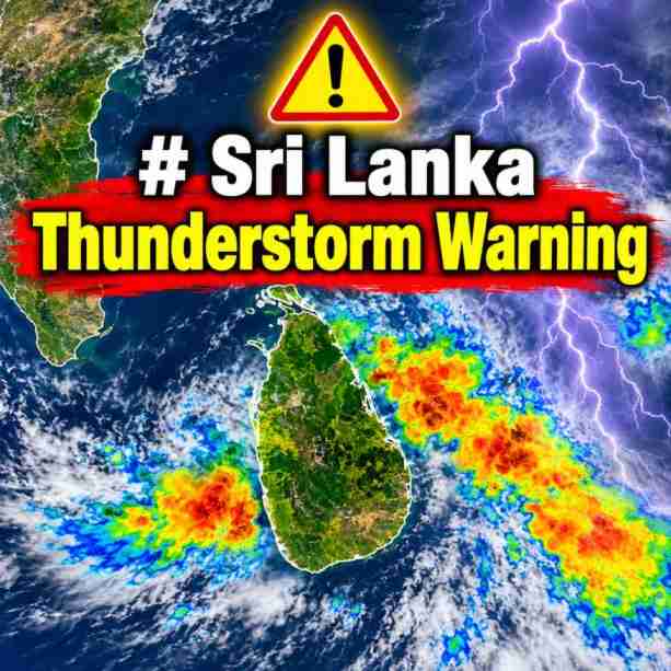
Amber-Level Thunderstorm Warning Issued for Several Areas
The Department of Meteorology has issued an Amber-level thunderstorm warning for several parts of Sri Lanka, alerting the public to an increased likelihood of severe lightning, heavy rainfall and strong gusty winds during the evening and night of 11 November 2026.
The warning, issued at 12:32 p.m. on 11 November, is valid until 1:00 a.m. on 12 November 2026. Heavy rainfall exceeding 100 mm is likely at some locations in the Western, Sabaragamuwa, Central, Southern and Uva provinces. Strong gusty winds reaching speeds of 60–70 kmph may also occur temporarily during thundershowers, while very rough sea conditions are expected in affected sea areas.
Districts and Areas Expected to Experience Severe Weather
According to the warning, the risk of severe lightning is expected to increase at several locations during the evening and night. The affected areas cover a wide range of districts across the island, including Colombo, Gampaha, Kalutara, Galle, Matara, Hambantota, Ratnapura, Kegalle, Kandy, Matale, Nuwara Eliya, Badulla, Monaragala, Kurunegala and Puttalam. Several areas in Ampara, Batticaloa, Anuradhapura, Mannar, Vavuniya, Mullaitivu and Polonnaruwa are also included in the warning.
The warning identifies all Divisional Secretariat divisions in several districts, including Colombo, Gampaha, Kalutara, Galle, Matara, Hambantota, Ratnapura, Kegalle, Kandy, Matale, Badulla, Monaragala, Kurunegala, Mannar, Nuwara Eliya and Polonnaruwa. Selected Divisional Secretariat divisions in other districts are also expected to experience adverse weather conditions.
Possible Impacts from Thunderstorms
Widespread thunderstorms accompanied by frequent lightning, heavy rain and strong gusty winds could cause damage in vulnerable areas. Trees may be uprooted, while roofs of houses, particularly those with non-engineered structures, tin sheets and thatched roofing, could be damaged by strong winds. Localised flash floods and slope failures are also possible in areas vulnerable to flooding and landslides.
People are particularly advised to remain cautious when staying in open locations such as paddy fields, plantations, playgrounds and beaches during thunderstorms. There is an increased risk of injury or death from lightning strikes in exposed areas. Fishing communities and people engaged in maritime activities should also exercise caution due to the possibility of temporarily very rough seas and strong wind gusts.

Low-Pressure Area Expected to Develop over the Bay of Bengal
Meanwhile, a developing weather system over the Bay of Bengal could influence regional weather conditions during the coming days. According to the regional weather outlook issued on 11 November 2026, an upper-air cyclonic circulation was present over the southern Andaman Sea and neighbouring areas, extending up to the middle tropospheric levels.
Under its influence, a low-pressure area is likely to form over the southeastern Bay of Bengal around 13 November. The system is expected to move northwestwards and may develop into a well-marked low-pressure area around 14 November, followed by a depression around 15 November over the same region.
Wind Speeds Expected to Increase over the Bay of Bengal
Squally weather, with wind speeds of 40–50 kmph and gusts reaching 60 kmph, is likely over the Andaman Sea on 14 and 15 November and over the southeastern Bay of Bengal from 14 to 16 November. Wind speeds are expected to increase to 45–55 kmph, with gusts reaching 65 kmph, over the southwestern Bay of Bengal during 15–17 November and the central Bay of Bengal during 16–17 November.
The regional bulletin indicates an increasing probability of cyclogenesis during the forecast period. The probability of depression formation is categorised as low during the 72–96-hour period, moderate during 96–120 hours and high during 120–144 hours. However, this does not confirm the formation of a tropical cyclone, and further monitoring will be necessary to determine the system’s development and movement.
Weather Conditions over the Arabian Sea
Over the Arabian Sea, a cyclonic circulation persisting near the southern Kerala coast and adjoining areas was observed over the southeastern Arabian Sea and neighbouring Lakshadweep region. Scattered to broken low- and medium-level clouds with embedded intense convection are expected over parts of the South Arabian Sea, Maldives, Comorin region and Lakshadweep Islands. Isolated weak to moderate convection is also expected over the northern and central Arabian Sea. No significant cyclogenesis is indicated over the Arabian Sea during the next 168 hours.
Public Advised to Remain Alert
The public is advised to remain alert to changing weather conditions and follow updates issued by the Department of Meteorology and relevant authorities. Extra care should be taken during evening and nighttime thunderstorms, particularly in areas expecting heavy rainfall, severe lightning and strong gusty winds. Fishing communities and people involved in maritime activities should also pay close attention to weather updates before going to sea.