
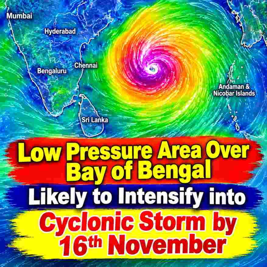
A low-pressure area has formed over the Southeast Bay of Bengal, marking the beginning of a weather system that could gradually intensify into a depression by November 15 and potentially develop into a cyclonic storm by November 16. Latest meteorological assessments indicate that the system is likely to move northwestwards initially before continuing in a north-northwestward direction over the Bay of Bengal.
According to the latest meteorological bulletin issued on November 13, 2026, an upper-air cyclonic circulation that was previously present over the Southeast Bay of Bengal merged with another upper-air cyclonic circulation over the central Andaman Sea and adjoining Andaman and Nicobar Islands .
Under the influence of this atmospheric circulation, a low-pressure area formed over the Southeast Bay of Bengal .
System May Intensify into a Depression by November 15
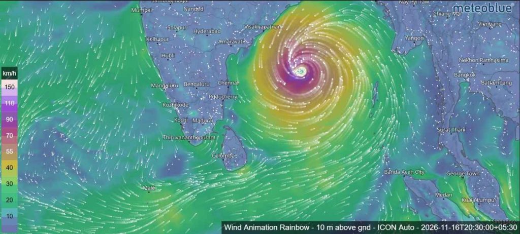
Meteorological assessments indicate that the low-pressure area is very likely to move northwestwards over the coming days. It is expected to strengthen into a well-marked low-pressure area on November 14, followed by further intensification into a depression around the morning of November 15 over the same region.
The system may then continue moving north-northwestwards and intensify further into a cyclonic storm over the central Bay of Bengal around the evening of November 16.
The latest probability assessment for cyclogenesis, which refers to the formation of a depression, indicates a gradual increase in the likelihood of development. The probability is classified as NIL during the first 24 hours, MODERATE during the 24–48-hour period and HIGH during the 48–72-hour period. No additional probability levels have been specified for the remaining forecast periods extending up to 168 hours.
These projections suggest that the next few days will be particularly important in determining the system’s development and eventual intensity.
Weather Models Indicate Possible Movement Towards Andhra Pradesh Coast
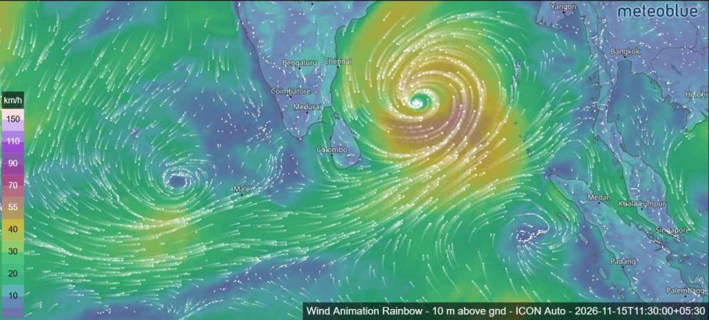
Most numerical weather prediction models are indicating the formation of the low-pressure area on November 13, followed by further intensification into depression or deep depression stages around November 15. Several models also suggest the possibility of the system becoming a cyclonic storm on November 16.
Regarding its movement, most models indicate an initial northwestward track, followed by a north-northwestward movement towards the Andhra Pradesh coast.
However, considerable differences remain among the models concerning the system’s subsequent movement, intensification and possible landfall location. The IMD GFS and CMC models are among those indicating a different movement pattern. Meanwhile, the IMD MME model also suggests further intensification into a cyclonic storm around November 16.
Therefore, the eventual direction and strength of the system remain uncertain, and its future development will need to be monitored through updated meteorological forecasts.
Atmospheric Conditions Favour Further Intensification
Several atmospheric factors are currently supporting enhanced convective activity over the Bay of Bengal.
Satellite observations from INSAT-3DS indicate a low-level circulation over the Southeast Bay of Bengal and adjoining areas. Scattered to broken low- and medium-level clouds, accompanied by embedded intense to very intense convection, are observed over the Andaman and Nicobar Islands.
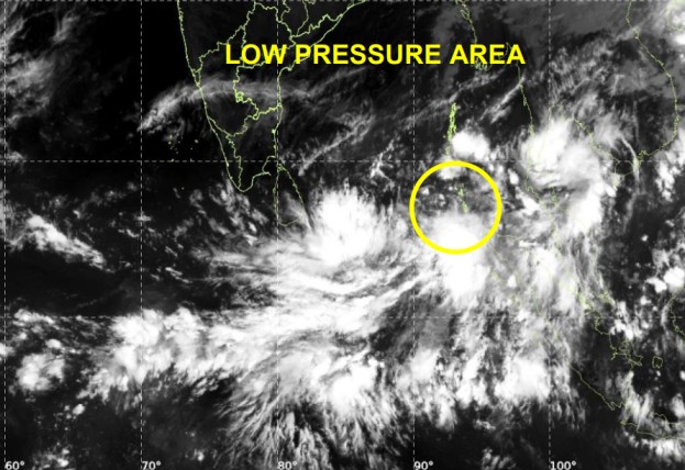
Cloud-top temperatures in these areas are estimated to range between -70°C and -90°C, indicating strong convective activity. Moderate to intense convection is also observed over Sri Lanka.
In addition, the Madden-Julian Oscillation (MJO) is currently in Phase 3, with an amplitude greater than one. According to the latest assessment, the MJO is likely to remain in the same phase until November 15 before moving into Phase 4 during the period from November 16 to 21.
This development is considered favourable for enhancing convective activity and supporting cyclogenesis over the Bay of Bengal during November 13–21.
Other atmospheric signals are also contributing to the favourable conditions. Guidance from the NCICS model indicates a strong westerly wind anomaly exceeding 9 metres per second over the southern Bay of Bengal during November 12–17, together with the presence of an equatorial Rossby wave and a Kelvin wave. The MJO, accompanied by an easterly wind anomaly to the north, is also expected to support further development of the system over the coming days.
Another Upper-Air Circulation Observed Over Arabian Sea
Meanwhile, a separate upper-air cyclonic circulation over the Southeast Arabian Sea and adjoining southern Lakshadweep area merged with an east-west trough extending from the circulation associated with the low-pressure area over the Southeast Bay of Bengal towards the northern Maldives, across the Southwest Bay of Bengal and adjoining Equatorial Indian Ocean.
Another upper-air cyclonic circulation is also present over the east-central Arabian Sea and adjoining northern parts of Lakshadweep, at approximately 3.1 km above mean sea level.
Scattered to broken low- and medium-level clouds with embedded intense convection are observed over the southern Arabian Sea, Maldives, Comorin area and Lakshadweep Islands. Isolated weak to moderate convection is also present over the north-central Arabian Sea.
However, the latest cyclogenesis probability assessment indicates NIL probability of depression formation over the Arabian Sea throughout the next 168 hours.
Possible Weather Implications for Sri Lanka
The latest satellite analysis has also identified moderate to intense convective activity over Sri Lanka. This indicates that atmospheric conditions remain favourable for cloud development over the island.
The developing low-pressure area is currently located over the Southeast Bay of Bengal, and its future movement and intensification will be important factors to monitor when assessing possible changes in regional weather conditions.
Although the system is not yet a depression, the forecast development between November 14 and 16 deserves close attention. Its eventual movement, intensity and possible landfall location are still subject to changes as new observations and numerical weather prediction models become available.
Naval and fishing communities, as well as the general public, are advised to follow official weather forecasts and updates issued by the relevant meteorological authorities as the system develops.
The period from November 14 to 16 will be particularly significant, with the possibility of the low-pressure area strengthening into a well-marked low-pressure area, then a depression and potentially a cyclonic storm over the Bay of Bengal.
