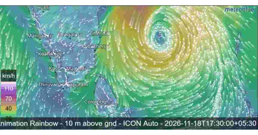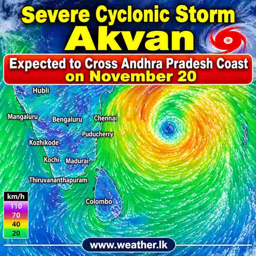
The Cyclonic Storm Akvan over the central parts of the South Bay of Bengal and adjoining Westcentral Bay of Bengal has intensified into a Severe Cyclonic Storm, according to the latest bulletin.
The system is moving slowly north-northwestwards and is expected to continue its movement towards the Andhra Pradesh and Yanam coasts of India. It is forecast to cross the coast between Nellore and Visakhapatnam on November 20, 2026.
Current Position and Intensity of Cyclone Akvan
According to the bulletin, Severe Cyclonic Storm Akvan was centred on November 18 near latitude 12.7°N and longitude 85.5°E. The system was approximately 580 km east of Chennai, 650 km northeast of Trincomalee, and 610 km southeast of Visakhapatnam.
The storm is moving north-northwestwards at a speed of approximately 3 kmph. Its maximum sustained wind speed is estimated at 90–100 kmph, gusting up to 110 kmph.
The latest forecast indicates that wind speeds could gradually increase to 100–110 kmph, with gusts reaching 120 kmph as the system approaches the Indian coastline.

Expected Landfall on November 20
The cyclone is very likely to move north-northwestwards and cross the Andhra Pradesh and Yanam coasts between Nellore and Visakhapatnam on November 20.
After making landfall, the system is expected to weaken gradually as it moves inland. The intrusion of cold and dry air over land is likely to contribute to its weakening.
However, there is some uncertainty among numerical weather prediction models regarding the exact landfall location, movement and intensity of the cyclone.
Forecast Track and Wind Speed
| Date and time (IST) | Forecast position (°N / °E) | Wind speed (kmph) | System category |
|---|---|---|---|
| Nov 18 – 05:30 AM | 12.7 / 85.5 | 90–100, gusting to 110 | Severe Cyclonic Storm |
| Nov 18 – 11:30 AM | 13.1 / 85.3 | 90–100, gusting to 110 | Severe Cyclonic Storm |
| Nov 18 – 05:30 PM | 13.5 / 85.1 | 95–105, gusting to 115 | Severe Cyclonic Storm |
| Nov 18 – 11:30 PM | 13.9 / 84.8 | 95–105, gusting to 115 | Severe Cyclonic Storm |
| Nov 19 – 05:30 AM | 14.4 / 84.4 | 100–110, gusting to 120 | Severe Cyclonic Storm |
| Nov 19 – 05:30 PM | 15.3 / 83.7 | 100–110, gusting to 120 | Severe Cyclonic Storm |
| Nov 20 – 05:30 AM | 16.4 / 83.0 | 100–110, gusting to 120 | Severe Cyclonic Storm |
| Nov 20 – 05:30 PM | 17.6 / 82.2 | 60–70, gusting to 80 | Cyclonic Storm |
| Nov 21 – 05:30 AM | 18.6 / 81.7 | 40–50, gusting to 60 | Depression |
| Nov 21 – 05:30 PM | 19.7 / 81.4 | 25–35, gusting to 45 | Well-Marked Low Pressure Area |
Atmospheric Conditions and Further Intensification
Satellite observations from INSAT-3DS indicate that the storm has a well-organised convective cloud pattern. The bulletin identifies the system’s intensity as T3.0.
The estimated central pressure is around 1000 hPa, while the maximum sustained wind speed is approximately 50 knots, gusting to 60 knots, according to the environmental analysis in the bulletin.
The system is currently experiencing conditions that may support further intensification. Low to moderate vertical wind shear and favourable atmospheric conditions are expected to help the cyclone strengthen gradually.
The bulletin also highlights the influence of the Madden-Julian Oscillation (MJO), which is in Phase 3 and is expected to move towards Phase 4. This may support enhanced convective activity over the Bay of Bengal.
However, after crossing the coastline, the cyclone is expected to weaken due to the intrusion of colder and drier air.
Uncertainty in the Forecast
Although most numerical weather prediction models indicate that the system will intensify into a Severe Cyclonic Storm, there are differences in model guidance regarding its subsequent movement, landfall location and intensity.
Some models suggest that the system could weaken below tropical cyclone strength before landfall, while others indicate that it may maintain its strength until reaching the coast.
The forecast confidence levels provided in the bulletin are:
- Current location: Moderate
- Current intensity: High
- Forecast track: Moderate
- Forecast intensity: Moderate
Possible Impacts on Sri Lanka
As of the latest bulletin, Cyclone Akvan is moving north-northwestwards over the Bay of Bengal, away from Sri Lanka. The system was approximately 610 km southeast of Machilipatnam and 650 km northeast of Trincomalee on November 18.
Its forecast track indicates continued movement towards the Indian coastline. Therefore, the latest bulletin does not indicate a direct landfall over Sri Lanka.
Nevertheless, people in Sri Lanka should continue monitoring official weather updates, as the movement and intensity of tropical weather systems can change.