
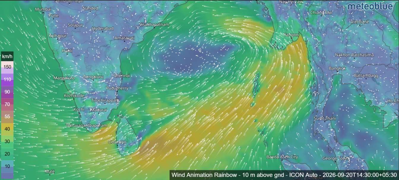
A low-pressure area over the Bay of Bengal is expected to gradually intensify and move west-northwestwards during the coming days, according to the Tropical Weather Outlook for the North Indian Ocean issued on 20 September 2026.
The weather system developed over the north Andaman Sea and adjoining areas at 1200 UTC on 19 September. By 0300 UTC on 20 September, it had moved into the eastcentral Bay of Bengal and adjoining north Andaman Sea.
According to the outlook, the system is very likely to continue moving west-northwestwards and strengthen into a depression over the eastcentral Bay of Bengal on 21 September. It is then expected to intensify further into a deep depression over the westcentral Bay of Bengal on 22 September.
The system is likely to continue its west-northwestward movement and could reach the westcentral and adjoining northwest Bay of Bengal near the north Andhra Pradesh–south Odisha coasts around 23 September 2026.
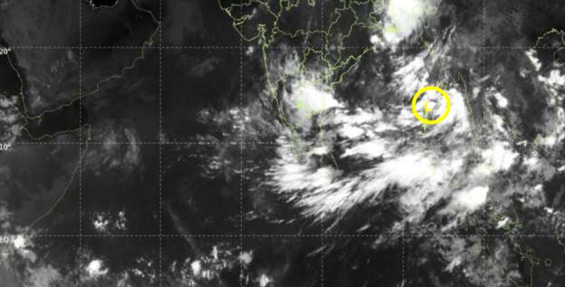
Satellite observations from INSAT-3D(S) indicate a low-level circulation over the north Andaman Sea and nearby areas. Scattered to broken low- and medium-level clouds, with embedded intense to very intense convection, are present over the Andaman Sea and parts of the Bay of Bengal. Very low cloud-top temperatures have also been observed, indicating significant convective activity.
The outlook also notes an upper-air cyclonic circulation over South Coastal Andhra Pradesh and the adjoining westcentral Bay of Bengal at around 0.9 km above mean sea level.
Cyclone Formation Probability
The outlook gives the following probability of cyclone formation during the next 168 hours:
- Next 24 hours: Low
- 24–48 hours: Moderate
- 48–72 hours: High
- 72–96 hours: High
- 96–120 hours: Very High
- 120–144 hours: Very High
- 144–168 hours: Nil
Weather conditions remain active over the Bay of Bengal, Andaman Sea, Arakan Coast, Gulf of Martaban and Tenasserim Coast, with scattered to broken clouds and embedded intense convection.
Residents and maritime interests in the region should continue to monitor official weather updates as the system develops.