

Weather conditions across Sri Lanka are expected to remain unsettled today, January 8, 2026, as a developing depression over the Bay of Bengal continues to influence the island’s atmospheric conditions. According to the Department of Meteorology, the depression was centered near latitude 5.3°N and longitude 86.0°E at 11.30 p.m. on January 7, placing it about 490 kilometres southeast of Pottuvil. The system is expected to move west-northwestwards toward the eastern coast of Sri Lanka within the next 24 hours and is very likely to intensify further into a deep depression during the next 12 hours. As a result, widespread cloudiness and enhanced rainfall are anticipated over most parts of the country.
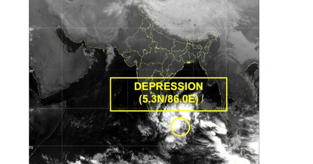
Cloudy skies are expected to prevail across the island throughout the day, creating favourable conditions for frequent showers and thunderstorms. Showers or thundershowers will occur at times in the Northern, North-Central, Eastern, Uva, Central and Southern provinces, while several other areas of the island may also experience showers or thundershowers, particularly after 1.00 p.m. Meteorologists warn that rainfall intensity could be significant in certain regions, with heavy falls exceeding 100 millimetres likely at some places in the Eastern and Uva provinces. Fairly heavy rainfall ranging between 50 and 75 millimetres is also expected at several locations in other parts of the island, increasing the risk of flooding and waterlogging.
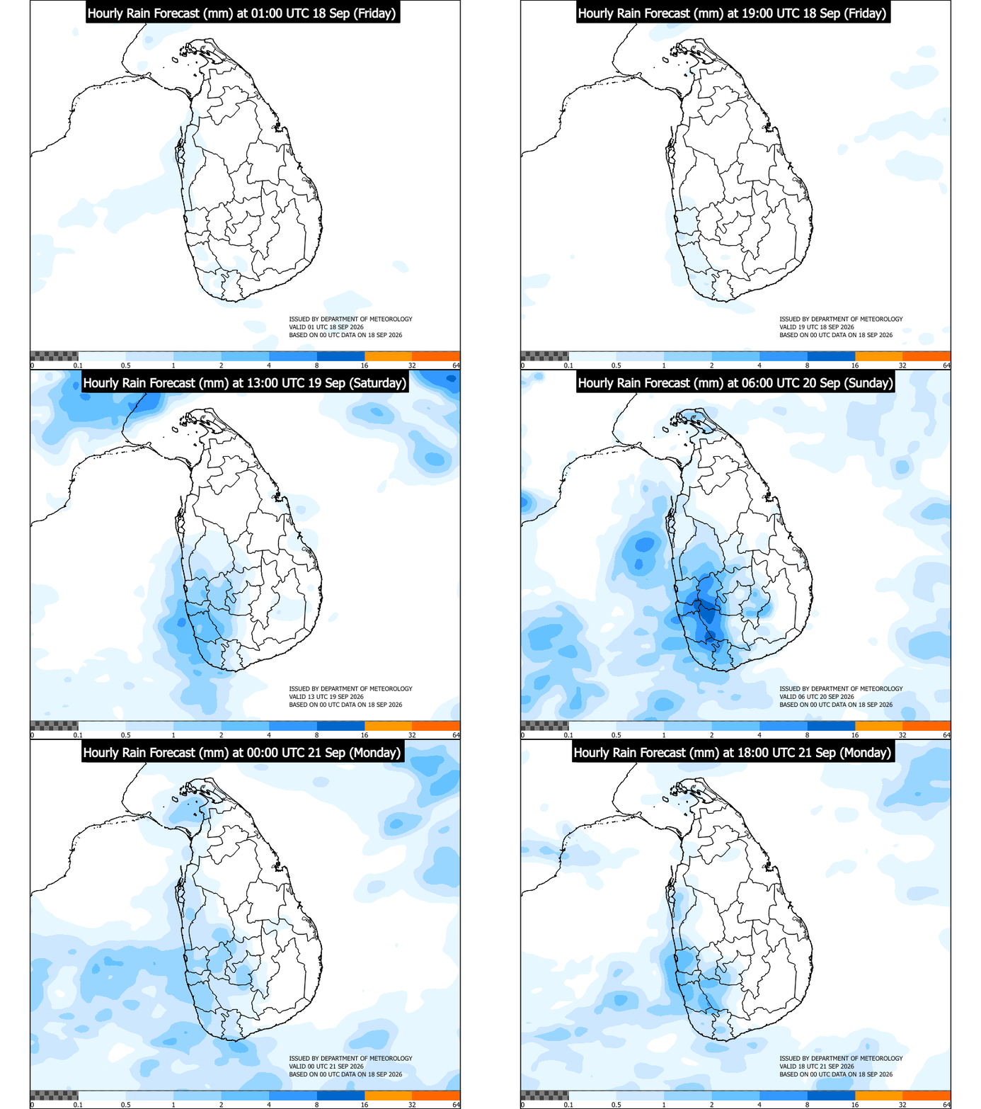
In addition to heavy rainfall, strong winds are expected to affect many regions today. Wind speeds of around 50 to 60 kilometres per hour may occur at times, especially over the eastern slopes of the central hills, as well as in the Northern, North-Central, North-Western and Eastern provinces. Districts including Hambantota, Gampaha, Colombo and Monaragala may also experience gusty winds, which could cause temporary disruptions to daily activities and transport. The Department of Meteorology urges the public to take necessary precautions to minimize damage caused by localized strong winds and lightning associated with thundershowers.

Authorities have warned of several possible impacts resulting from the adverse weather conditions. People living in hilly areas, particularly in landslide-prone locations, and residents in low-lying areas within river basins are requested to remain vigilant due to the risk of landslides, flash floods and sudden rises in water levels. Drivers and road users in hill country areas are advised to exercise caution, as falling trees, rocks and poor visibility may pose hazards. Damage to huts, temporary shelters and light structures is possible, along with the destruction of rooftops and roofing sheets. Power and communication lines may also be affected, while breaking tree branches and uprooting of large trees could block roads and damage property. Agricultural activities may suffer, with potential damage to paddy fields, banana and papaya cultivation and orchards. Coastal areas may face flash flooding and seawater inundation in low-lying zones near the shore.

As precautionary measures, coastal hutment dwellers are advised to move to safer locations, while other residents in affected areas are encouraged to remain indoors during severe weather. The public is warned to beware of fallen trees and power lines and to avoid using wired telephones and connected electrical appliances during thunderstorms. Naval and fishing communities are strongly warned not to venture into deep and shallow sea areas around the island until further notice, particularly in sea areas extending from Kankasanthurai to Hambantota via Trincomalee and Pottuvil, as well as in regions bounded between 02°N–13°N and 80°E–90°E. Those already at sea are advised to return to the nearest coast or move to safer areas immediately.
The Department of Meteorology continues to closely monitor the behavior of this system and will issue further updates as necessary. The general public is urged to remain attentive to future forecasts and advisories and to follow instructions issued by disaster management authorities to ensure safety during this period of severe weather.