
Heavy Showers Expected in Several Areas
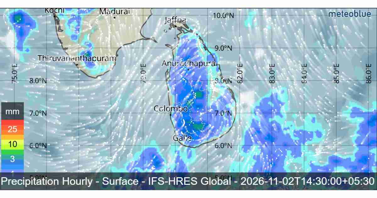
Sri Lanka is expected to experience showers and thundershowers across several parts of the island on Monday, November 2, 2026, according to the latest weather forecast. Fairly heavy rainfall exceeding 50 mm is possible in several provinces, while strong winds, lightning and rough sea conditions are also expected in some areas.
Showers or thundershowers are likely at several places in most parts of the island after 1:00 p.m. Some locations in the Sabaragamuwa, Central and North Central provinces, as well as Trincomalee and Mullaitivu districts, may receive fairly heavy rainfall exceeding 50 mm.
Morning showers are also expected in parts of the Western and Southern provinces. Meanwhile, misty conditions may develop during the early morning hours in some areas of the Sabaragamuwa, Central and Uva provinces, along with Kurunegala and Anuradhapura districts.
The public is advised to take necessary precautions to minimize possible damage caused by temporary localized strong winds and lightning during thundershowers.

Cyclonic Storm Murasu Intensifies Over the Bay of Bengal
The Cyclonic Storm “Murasu”, located over the west-central and adjoining southwest Bay of Bengal, is another significant weather system being monitored by meteorological authorities.
At 11:30 p.m. on November 1, the system was centred near latitude 13.3°N and longitude 83.0°E, approximately 480 km north-northeast of Kankesanthurai.
According to the forecast, Murasu is very likely to move west-northwestwards and intensify into a Severe Cyclonic Storm over the west-central Bay of Bengal. It is subsequently expected to move northwestwards and cross the south Andhra Pradesh coast between Nellore and Narsapur as a Severe Cyclonic Storm between midnight on November 2 and the early hours of November 3.
Sea Conditions and Wind Forecast Around Sri Lanka
Showers or thundershowers are expected at several places in the sea areas surrounding Sri Lanka during the next 24 hours.
Southwesterly or southerly winds are expected over the surrounding sea areas at speeds of 25–35 kmph. Wind speeds may occasionally increase to 40–45 kmph in the sea areas extending from Chilaw to Pottuvil via Colombo, Galle and Hambantota.
These sea areas may become fairly rough at times, while other sea areas around the island are expected to remain moderate under normal conditions.
However, temporarily strong gusty winds reaching 60–70 kmph and very rough seas can be expected during thundershowers.

Special Advisory for Naval and Fishing Communities
The Department of Meteorology has warned naval and fishing communities not to venture into the deep-sea areas bounded by 10°N–17°N and 80°E–90°E until further notice due to the developing cyclone.
Those already operating in these areas are advised to move to safer locations.
Additionally, fishing and naval communities are advised to avoid both deep and shallow sea areas extending from Mannar to Trincomalee via Kankesanthurai until further notice.
All communities involved in maritime activities are requested to remain attentive to future weather forecasts and official bulletins issued by the Department of Meteorology.
The public and fishing communities are encouraged to follow official weather updates as conditions may change with the development and movement of Cyclonic Storm Murasu.