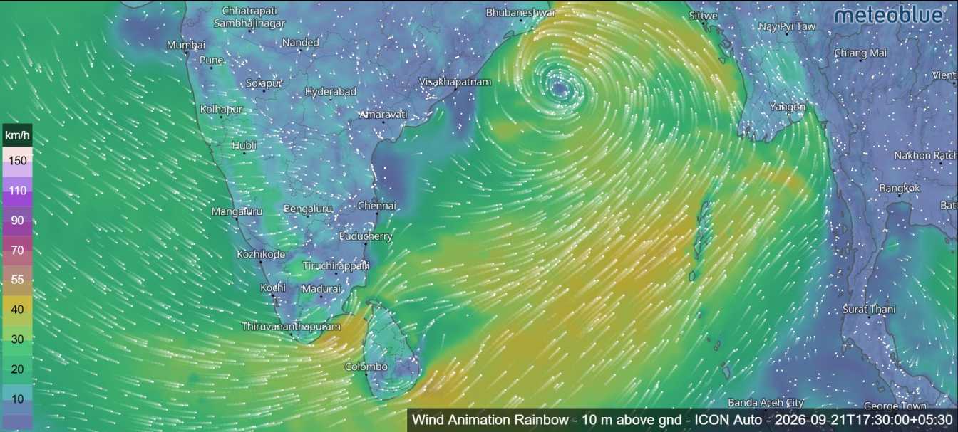
Sri Lanka is expected to experience continued unsettled weather on 22 September, particularly across the southwestern parts of the island. A low-pressure area over the Andaman Sea region of the Bay of Bengal, northeast of Sri Lanka, is expected to intensify into a depression within the next 24 hours.
Although the weather system is not expected to have a direct impact on Sri Lanka, its influence on the surrounding wind flow is likely to maintain rainy conditions, especially across the southwestern regions. Showers or thundershowers will occur at times in the Western, Sabaragamuwa, Central and North-western provinces, as well as in the Galle and Matara districts. Heavy rainfall of around 100 mm is possible at some locations in these areas.
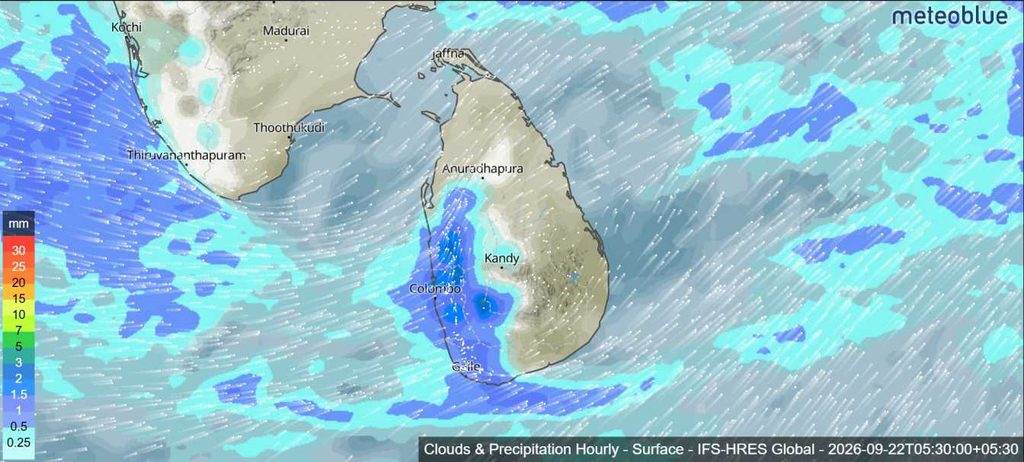
Several spells of showers may also occur in the North-central Province and Mannar district. Meanwhile, the Uva Province and the Batticaloa and Ampara districts are expected to experience showers or thundershowers at several places after 2.00 p.m. The afternoon and evening rainfall could be accompanied by temporary localized strong winds and lightning.
Strong winds are also expected in several parts of the country. Wind speeds of around 40–50 kmph may occur at times over the western slopes of the Central Hills, North-central and North-western provinces, as well as in Trincomalee, Hambantota and Matale districts. The public is advised to take appropriate precautions during thundershowers to reduce possible damage from strong winds and lightning.
Sea Weather Around Sri Lanka
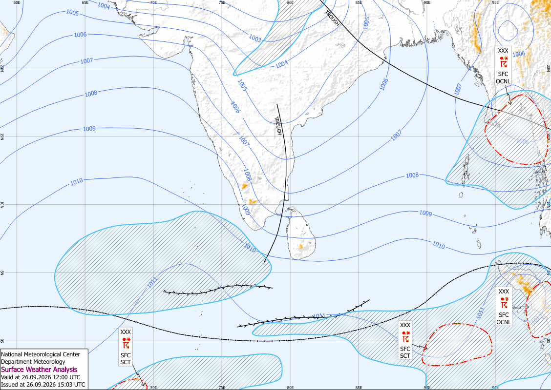
Weather conditions over the surrounding seas will also be affected by the developing low-pressure system. The system is expected to strengthen the wind and rainy conditions over the Bay of Bengal. Naval and fishing communities operating in these waters are advised to remain vigilant and closely follow future forecasts and bulletins issued by the Department of Meteorology.
Showers or thundershowers will occur at times in the sea areas extending from Kankasanthurai to Hambantota via Puttalam, Colombo and Galle. Showers or thundershowers may also develop in several other sea areas during the evening or night.
Winds will be south-westerly at speeds of around 30–40 kmph. Wind speeds may increase up to 50–60 kmph at times in the sea areas extending from Kankasanthurai to Chilaw via Mannar and from Matara to Pottuvil via Hambantota.
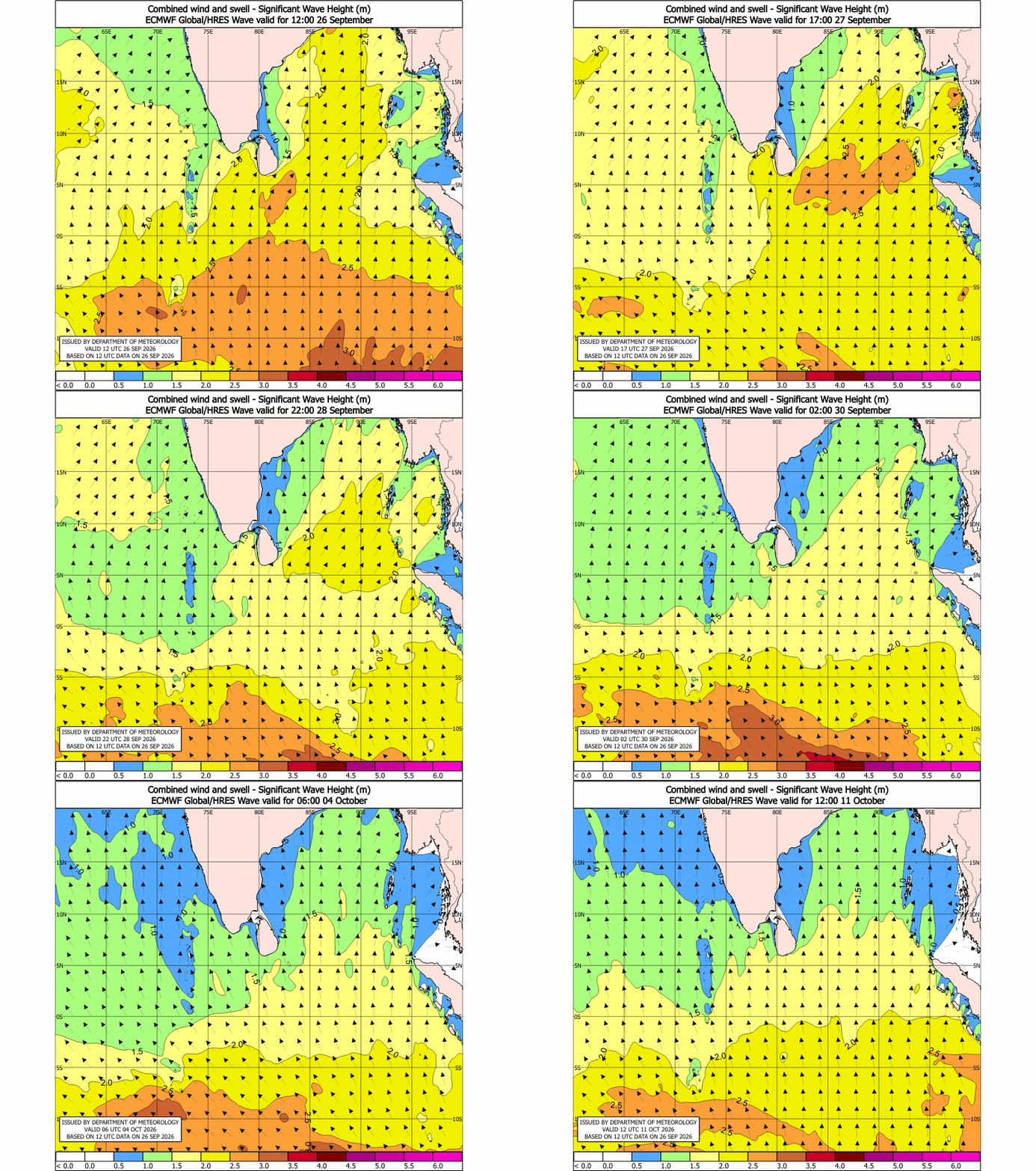
Sea conditions in the areas from Kankasanthurai to Chilaw and from Matara to Pottuvil are expected to be rough at times. Wave heights may increase to around 2.0–2.5 metres in the sea areas extending from Puttalam to Pottuvil via Colombo, Galle and Matara. During thundershowers, temporarily strong gusty winds and very rough seas can occur.