
Cyclone Akvan Intensifies Over Bay of Bengal, Expected to Become a Very Severe Cyclonic Storm by November 19
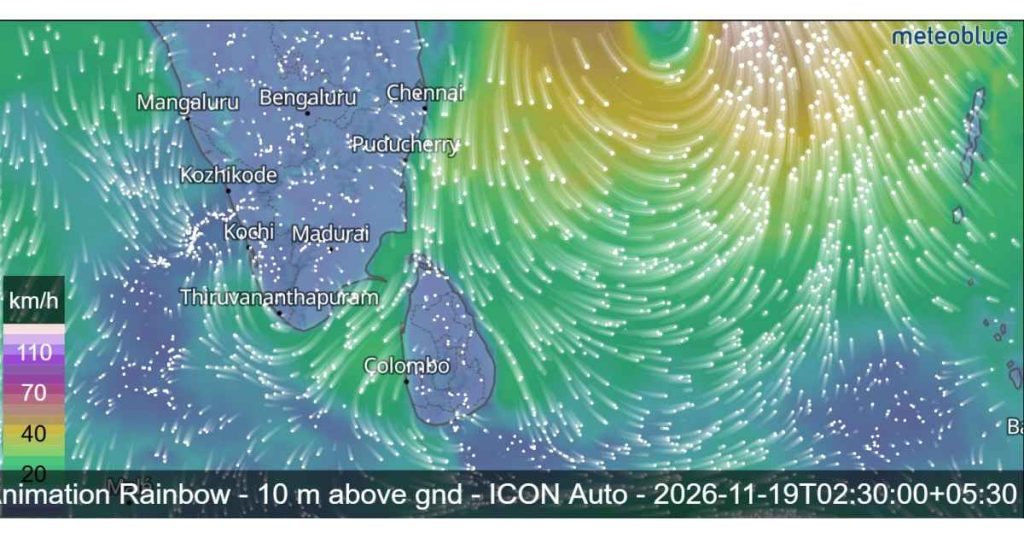
Cyclone Akvan has intensified over the Bay of Bengal after developing from a Deep Depression, and is expected to strengthen further into a Very Severe Cyclonic Storm within the next few days. According to the latest weather forecast on November 17, 2026, the system is moving north-northwestwards and is expected to continue strengthening over the coming days.
The developing cyclone is being closely monitored as it moves across the Bay of Bengal towards the eastern coast of India. Meanwhile, Sri Lanka is expected to experience showers in several provinces, while dangerous sea conditions and strong winds are anticipated in surrounding maritime areas.
Cyclone Akvan Intensifies Over the Bay of Bengal
According to the Department of Meteorology, the Deep Depression over the Southeast Bay of Bengal and adjoining Southwest Bay of Bengal has intensified into a Cyclonic Storm and has been officially named Akvan (pronounced: Akvan).
The system was centred near latitude 12.2°N and longitude 85.7°E at around 11.30 p.m. on November 16. At that time, it was located approximately 640 kilometres from Trincomalee.
The cyclone is very likely to continue moving in a north-northwesterly direction and strengthen further into a Severe Cyclonic Storm over the Westcentral Bay of Bengal around 5.30 p.m. on November 17.
Meteorological forecasts indicate that Akvan could intensify further into a Very Severe Cyclonic Storm around 5.30 a.m. on November 19 as it continues moving northwestwards.
The system is then expected to approach the eastern coast of India. Current projections indicate that Cyclone Akvan is likely to cross the Andhra Pradesh and Yanam coasts between Nellore and Tuni around 11.30 a.m. on November 20 as a Very Severe Cyclonic Storm.
Weather Forecast for Sri Lanka on November 17
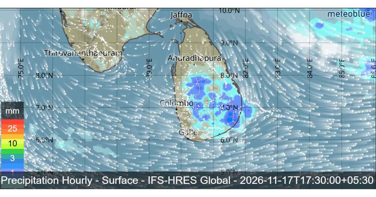
While Cyclone Akvan continues to strengthen over the Bay of Bengal, several areas of Sri Lanka are expected to experience showers on November 17.
According to the latest forecast, several spells of showers will occur in the Western, Sabaragamuwa and North-Western provinces. Rainfall is also expected in the Kandy, Nuwara Eliya, Galle and Matara districts.
Meanwhile, showers or thundershowers may develop at a few places in the Uva Province and in the Ampara and Hambantota districts after 2.00 p.m.
Mainly fair weather is expected to prevail over the other areas of the island.
Misty conditions may also occur in most parts of the country during the early hours of the morning. Motorists are advised to remain cautious when travelling through areas affected by reduced visibility.
The public is also requested to take necessary precautions against temporary localized strong winds and lightning that may occur during thundershowers.

Dangerous Sea Conditions Expected Around Sri Lanka
The Department of Meteorology has issued an important warning for naval and fishing communities due to the strengthening cyclone over the Bay of Bengal.
According to the marine weather forecast, showers or thundershowers may occur at several places in the sea areas around the island.
North-westerly or westerly winds are expected across the surrounding sea areas, with wind speeds generally ranging between 30 and 40 kmph.
However, wind speeds could increase up to 60 kmph at times in the sea areas extending from Kankasanthurai to Pottuvil via Trincomalee and Batticaloa. In other sea areas around the island, wind speeds may increase up to 50 kmph at times.
The sea areas from Kankasanthurai to Pottuvil via Trincomalee and Batticaloa are expected to become rough at times. Other surrounding sea areas may be fairly rough.
During thundershowers, temporarily strong gusty winds of 60–70 kmph and very rough seas can be expected.

Special Warning for Naval and Fishing Communities
In view of the developing weather system, the Department of Meteorology has warned naval and fishing communities not to venture into the deep-sea areas bounded by 05°N–18°N and 80°E–95°E.
Communities operating in the sea areas extending from Kankasanthurai to Pottuvil via Trincomalee and Batticaloa have also been advised to move to safe locations.
Naval and fishing communities are strongly advised to follow the latest weather forecasts and official bulletins issued by the Department of Meteorology.
As Cyclone Akvan is expected to intensify further over the Bay of Bengal, the public and maritime communities should remain alert and follow official weather updates.
The situation will continue to be monitored closely over the coming days as the cyclone moves towards the eastern coast of India.