
Sri Lanka Temporary Reduction in Rainfall Expected
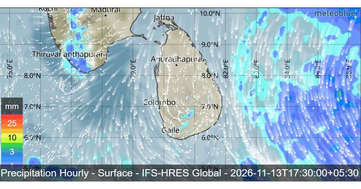
Sri Lanka is expected to experience a temporary reduction in showery weather today (13 November), although several areas will continue to receive rain. Meanwhile, attention is also focused on a developing weather system over the Southeast Bay of Bengal, where a low-pressure area is expected to form today and may gradually strengthen into a depression by 15 November.
Several spells of showers are expected in the Eastern Province and in the districts of Mullaitivu and Polonnaruwa.
Elsewhere, the weather is expected to remain relatively less showery during the morning. However, showers or thundershowers may develop at a few places in the Western, Sabaragamuwa, Central and Southern provinces after 1.00 p.m.
The public is advised to remain cautious during thundershowers, as temporary localized strong winds and lightning could occur. Taking appropriate precautions is important to minimize possible damage and avoid unnecessary exposure during these conditions.
Misty weather is also expected in some areas during the early morning hours. The Western, Sabaragamuwa, Central and Uva provinces, along with the Galle, Matara and Kurunegala districts, are among the areas where mist may develop.

Low Pressure Area Expected Over Southeast Bay of Bengal
A developing weather system over the Bay of Bengal is another important feature in the latest forecast. The Department of Meteorology indicates that a low-pressure area is likely to form over the Southeast Bay of Bengal around 13 November.
The system is expected to move northwestwards while gradually intensifying. It may develop into a well-marked low-pressure area around 14 November before becoming a depression around 15 November over the same region.
Naval and fishing communities are requested to remain attentive to future weather forecasts and bulletins issued by the Department of Meteorology regarding the development and movement of this system.
Sri Lanka Rainfall and Wind Conditions in Sea Areas
During the next 24 hours, showers or thundershowers are expected at several places in the sea areas extending from Kankasanthurai to Galle, passing Trincomalee, Batticaloa and Hambantota.
Winds around the island are expected to remain northeasterly, with speeds generally ranging between 20 and 30 kmph. However, wind speeds may occasionally increase up to 45 kmph in the surrounding sea areas.
Sea conditions are expected to be fairly rough at times. More challenging conditions may develop during thundershowers, when temporarily strong gusty winds reaching 60–70 kmph and very rough seas are possible.
Fishing and naval communities should therefore pay close attention to changing sea conditions, particularly when planning fishing activities and navigation. The possibility of sudden increases in wind speed and rough seas during thundershowers should not be overlooked.
The expected temporary reduction in rainfall across the island does not mean that wet weather will completely disappear. Rainfall is still likely in several provinces and districts, while the developing low-pressure system over the Southeast Bay of Bengal will remain an important weather development to monitor over the coming days.
