Cyclone Arnab Forecast: Andhra Pradesh Landfall on October 28
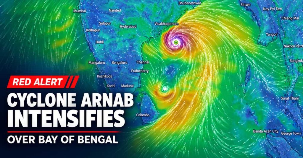
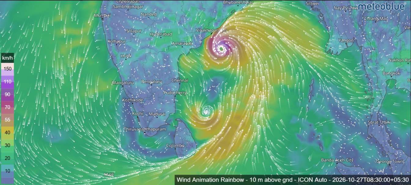
A cyclonic storm named Arnab over the Bay of Bengal is forecast to intensify into a very severe cyclonic storm before approaching the Andhra Pradesh coast on October 28, according to the tropical cyclone advisory issued by the Regional Specialized Meteorological Centre (RSMC), New Delhi.
The developing system is moving westward across the east-central and adjoining west-central Bay of Bengal. Forecast guidance indicates that it could bring destructive winds, heavy rainfall, rough seas and coastal flooding to parts of southeastern India.
The latest advisory, issued at 03:00 UTC on October 26, places Andhra Pradesh and adjoining southern Odisha under a pre-cyclone watch as the storm continues to strengthen.
Cyclone Arnab: Current Location and Intensity
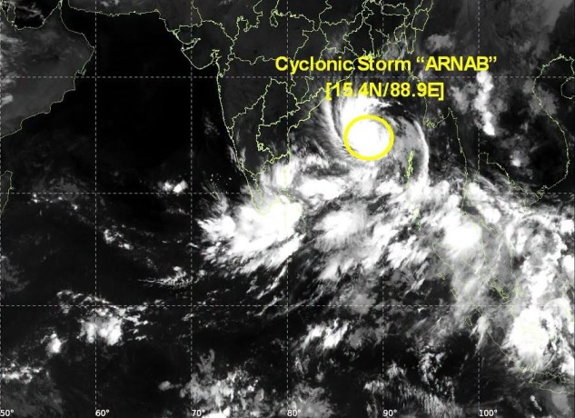
At 00:00 UTC on October 26, the cyclone was centred near 15.4°N latitude and 88.9°E longitude over the east-central and adjoining west-central Bay of Bengal.
The system had moved westward at approximately 15 km/h during the preceding six hours. Its estimated maximum sustained wind speed was 60–70 km/h, with gusts reaching 80 km/h.
At the time of the bulletin, the cyclone was located approximately:
- 590 km southeast of Sri Vijaya Puram in the Andaman Islands.
- 610 km southeast of Gopalpur in Odisha.
- 650 km east-southeast of Visakhapatnam in Andhra Pradesh.
- 730 km east of Kakinada in Andhra Pradesh.
- 830 km east of Machilipatnam in Andhra Pradesh.
- 910 km east of Bapatla in Andhra Pradesh.
These positions indicate that the storm was still over the sea, with further development expected as it moves towards the Indian coastline.


Cyclone Arnab Forecast: October 26–30
Meteorological projections suggest that Cyclone Arnab will continue moving westward before turning towards the west-northwest. The system is expected to strengthen considerably during October 26 and 27.
According to the forecast, the storm could reach very severe cyclonic storm intensity on October 27, with maximum sustained winds of 110–125 km/h and gusts of up to 140 km/h.
The system is then expected to approach the Andhra Pradesh coast, with a possible landfall between Bapatla and Visakhapatnam during the early hours of October 28.
After moving inland, the cyclone is forecast to weaken progressively. Its remnants could lose strength further over eastern India by October 29 and develop into a well-marked low-pressure area by October 30.
Expected Cyclone Development
| Date and time (UTC) | Forecast intensity | Maximum sustained winds |
|---|---|---|
| Oct 26, 00:00 | Cyclonic storm | 60–70 km/h |
| Oct 26, 12:00 | Cyclonic storm | 80–90 km/h |
| Oct 26, 18:00 | Severe cyclonic storm | 90–100 km/h |
| Oct 27, 00:00 | Very severe cyclonic storm | 110–120 km/h |
| Oct 27, 12:00 | Very severe cyclonic storm | 115–125 km/h |
| Oct 28, 00:00 | Very severe cyclonic storm | 115–125 km/h |
| Oct 28, 12:00 | Cyclonic storm | 70–80 km/h |
| Oct 29, 00:00 | Deep depression | 50–60 km/h |
| Oct 29, 12:00 | Depression | 40–50 km/h |
| Oct 30, 00:00 | Depression | 30–40 km/h |
Wind speeds are forecast values from the bulletin and may change with subsequent updates. UTC is 5 hours and 30 minutes behind Indian Standard Time.
Possible Landfall Between Bapatla and Visakhapatnam
One of the key concerns in the latest forecast is the possibility of Cyclone Arnab crossing the Andhra Pradesh coast between Bapatla and Visakhapatnam.
The bulletin indicates that landfall could occur around 06:00 UTC on October 28, equivalent to approximately 11:30 a.m. Indian Standard Time. The cyclone could have maximum sustained winds of 115–125 km/h, with gusts reaching 140 km/h near the time of crossing.
The projected landfall location and timing are not final. Cyclone tracks can change as atmospheric conditions evolve, so coastal communities should follow the latest official advisories rather than relying on a single forecast.
Coastal Flooding and Storm Surge Risk
In addition to strong winds and rainfall, the bulletin warns of a possible storm surge of approximately 1.0–1.5 metres above the astronomical tide.
Such a surge could inundate low-lying coastal areas of East Godavari district and Yanam in Puducherry during landfall.
The actual extent of coastal flooding will depend on the cyclone’s final track, intensity, tide levels and local coastal conditions. Residents in vulnerable areas should pay attention to evacuation instructions and warnings issued by local authorities.
Heavy Rainfall and Dangerous Sea Conditions
As Cyclone Arnab approaches the coast, areas of Andhra Pradesh and adjoining regions could experience periods of heavy rainfall and strong winds.
Rough to very rough sea conditions are also a concern along the storm’s projected path. Fishermen, cargo vessels and other maritime operators should closely monitor official marine weather warnings and comply with restrictions on going to sea.
Strong winds and intense rainfall may also affect road travel, coastal infrastructure, electricity supplies and other essential services, particularly in areas near the eventual landfall zone.
The potential impacts will depend on how quickly the cyclone strengthens and where it crosses the coastline.
Why Is Cyclone Arnab Expected to Strengthen?
The meteorological assessment identifies several environmental factors that may support further intensification over the Bay of Bengal.
Sea-surface temperatures are around 30°C over the east-central and adjoining west-central Bay of Bengal. Warm ocean water can supply energy and moisture to a developing tropical cyclone.
The bulletin also describes favourable atmospheric conditions, including supportive large-scale circulation and wind patterns. These factors may help the storm organize and strengthen before reaching the coast.
However, the eventual intensity will depend on how these conditions evolve, including changes in wind shear, moisture availability and the cyclone’s interaction with land.
What Happens After Landfall?
The forecast indicates that Cyclone Arnab should weaken after moving inland on October 28.
By October 29, the system is expected to lose much of its strength and could become a depression. Further weakening is forecast by October 30, when it may develop into a well-marked low-pressure area.
Although weakening after landfall is typical of tropical cyclones moving over land, dangerous weather can continue even after wind speeds decrease. Heavy rainfall, local flooding and disruptions to transport and infrastructure may persist in affected areas.
Safety Advice for Coastal Residents
People living in coastal Andhra Pradesh and nearby vulnerable areas should take the following precautions:
- Follow official cyclone bulletins and local emergency announcements.
- Keep away from beaches, exposed coastlines and rough seas.
- Avoid fishing and other maritime activities when warnings or restrictions are in force.
- Secure loose outdoor objects and prepare essential supplies.
- Keep important documents, medicines, drinking water and emergency lighting ready.
- Follow evacuation instructions from local authorities without delay.
Do not rely on social media rumours or outdated cyclone-track maps. Use the latest information from the relevant meteorological and disaster-management authorities.
Latest Update on Cyclone Arnab
Cyclone Arnab is forecast to strengthen into a very severe cyclonic storm over the Bay of Bengal before approaching the Andhra Pradesh coast around October 28. The projected crossing between Bapatla and Visakhapatnam could bring powerful winds and a risk of coastal inundation.
The bulletin assesses confidence in the current location and intensity as high, while confidence in the forecast track and future intensity is moderate to high. This means the overall development is supported by the forecast guidance, but the exact track, landfall timing and peak strength may still change.
Residents in potentially affected areas should remain alert and monitor official weather updates as the system approaches the coast.
Source: Tropical Cyclone Advisory No. 01 for the North Indian Ocean, issued by RSMC New Delhi on 26 October 2026. Forecast details are based on the supplied bulletin and may change in subsequent advisories.